Arab Canada News
News
Published: January 10, 2024
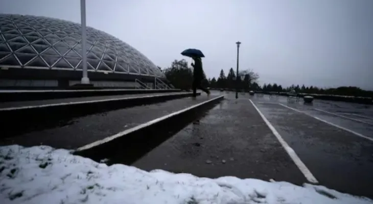
Wind speeds are expected to reach 100 kilometers per hour on Tuesday and Wednesday along some parts of southwestern British Columbia, where winter storms are causing ferry cancellations, power outages, and avalanche warnings.
Wind warnings are in place in west Vancouver Island, Greater Victoria, and the southern Gulf Islands, where Environment Canada has also issued a special weather statement for above-normal ocean levels along the shores of the Juan de Fuca Strait, including Sooke and Victoria, with similar conditions expected near Boundary Bay in Metro Vancouver.
The forecaster said that ocean levels are expected to exceed the highest astronomical tide and may cause some coastal flooding.
"Following some fairly wintry weather we saw around the southern coast yesterday, we still have a low-pressure system crossing the Georgia Strait this morning and moving inland this afternoon, and with this we will see some," said Ross MacDonald, a meteorologist with Environment Canada.
Ferry sailings were also cancelled at 7:45 a.m. from Duke Point in Nanaimo to Tsawwassen, with the return sailing at 10:15 a.m.
Power outages
Power outages were affecting nearly 10,000 British Columbia Hydro customers on Vancouver Island and the Gulf Islands as of noon Pacific Time, with Langford, Metchosin, Sooke, and Victoria being the most affected. More than 16,000 customers lost power earlier yesterday.
Also, nearly 4,000 additional customers in the Lower Mainland and Sunshine Coast areas were affected, mostly in the Fraser Valley.
Heavy snow, avalanche warning...
In the interior, snowfall that began on Monday has made travel difficult on roads and highways.
Snowfall and winter storm warnings remain in effect in most interior areas, with snow accumulations of 20 to 30 cm expected on the Coquihalla Highway between Hope and Merritt on Wednesday.
Snow is also accumulating on Highway 3 from Hope to Princeton and on Highway 1 between Eagle Pass and Rogers Pass. Heavy snowfall is also expected in the Cariboo, Okanagan, Shuswap, northern and western Columbia areas, and the Prince George region, according to Environment Canada.
At the same time, Avalanche Canada warns that very dangerous avalanche conditions exist at higher elevations in several areas across southwestern British Columbia, as well as southeastern Rocky Mountains.
Travel is not recommended in avalanche terrain, as stated on their website for areas including rural locations around Whistler and the Fraser Valley.


Thursday, 03 July 2025
--°C
--°C


Comments