Arab Canada News
News
Published: March 22, 2024
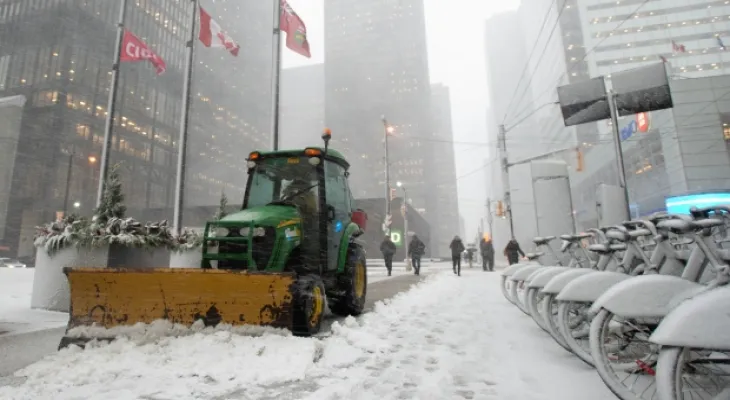
The Canadian Environment Agency issued a warning of snowfall in most of the Greater Toronto Area and parts of Ontario before a snowstorm that could lead to up to 15 cm of snow in some areas later on Friday.
"Light snowfall is expected to begin this morning, but is expected to intensify late afternoon or evening. The warning stated, “Snowfall will subside from west to east late tonight.”
The warning added that the snow could have a "significant impact" on evening commutes in urban areas.
The snowfall warning extends from Hamilton in the west to Kingston and Gananoque in the east around Lake Ontario. It includes Mississauga, Brampton, Vaughan, Markham, Oshawa, and other areas.
Bill Coulter, a meteorologist at CP24, said: "It’s not huge compared to what we’ve seen in past years, but this could be the biggest snowfall we've seen so far this season."
He continued, "I think most areas along the north shore of Lake Ontario will see about 10 centimeters, but due to the easterly winds exploiting the cold air, these small bands will get some localized lake enhancements that will push them to 15 or more."
According to Environment Canada, the peak snowfall could reach 2 cm per hour, and the storm may lead to reduced visibility.
The warning said: "Be prepared to adjust your driving with changing road conditions." "If visibility drops while driving, turn on your lights and maintain a safe following distance."
Coulter said the "bulk" of the snow is expected to move around 3 or 4 pm. It continues through the evening rush hour.
He added, "An advance warning is a warning. So, you know if you have some flexibility in your plans, maybe postpone things or find alternative transportation to get out and enjoy a Friday night safely."
The city also advises people to allow extra time for travel, especially with many road closures and transit shutdowns in effect this weekend.
Starting tonight around 11 pm, Metrolinx says Lakeshore West service will be temporarily suspended between West Harbour GO and Union Station to allow for important track work along the corridor. Normal service will resume on Monday.
Pearson International Airport also tweeted on X that they are preparing for snow and informed people of possible flight cancellations.
The airport said: "Our crews are getting our specialized snow removal equipment ready to keep runways, aprons, and taxiways as clear as possible." "With any winter storm, there is a possibility that airlines will have to cancel and delay some flights."
They advised travelers to stay updated.
Toronto is expected to see temperatures reach -1 degrees Celsius today, although it will feel like -12 in the morning and -5 in the afternoon.
The weather is expected to be warmer for the rest of the weekend, with sunshine and highs reaching 4 degrees Celsius on Saturday and 3 degrees Celsius on Sunday. Temperatures in Toronto are expected to reach 8 degrees Celsius on Monday.
Coulter said: "A slight warm-up is expected on Saturday." "So expect lots of melting and puddles will jump. Seasonal moderate weather will eventually return to the area by mid next week."


Friday, 04 July 2025
--°C
--°C


Comments