Arab Canada News
News
Published: July 9, 2024
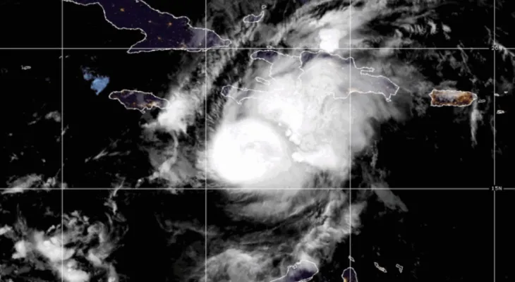
The hurricane, which has since been downgraded and claimed many lives while leaving destruction in its path, is expected to hit parts of Canada this week as a tropical storm.
Hurricane Beryl had previously caused devastation in parts of the Caribbean, Mexico, and Texas. Its status was downgraded from a Category 1 hurricane to a post-tropical storm on Tuesday morning.
It is now classified as a weak tropical low and is expected to head northeast towards Texas, eventually reaching parts of Canada.
The areas where Environment Canada expects Beryl's impact to be felt.
Ontario
As of Tuesday, Beryl is set to arrive in Ontario and Quebec on Wednesday and Thursday, with rain and a risk of thunderstorms forecasted, according to Environment Canada.
Regions in southern and eastern Ontario, including Toronto and Ottawa, are under a special weather warning. Environment Canada warns that while the exact track of the system is still difficult to determine, rainfall amounts could exceed 50 mm in some locations, with the possibility of heavy rain at times.
The meteorological agency stated that some parts of the province are expected to start receiving rain as early as Tuesday, with rainfall rates reaching between 20 to 40 mm per hour.
While strong winds are often associated with major storms, the weather bulletin indicated that wind speeds are expected to reach around 20 km/h overnight and 30 km/h on Wednesday.
Meanwhile, some areas of Ontario, including Toronto, Burlington, and Hamilton, are experiencing heat waves. Daily highs exceed the 30-degree mark in many areas, while humidity levels range from 35 to 38.
Environment Canada stated that a cooler air mass is expected to arrive on Tuesday evening.
Quebec
When the remnants of Beryl hit Quebec, areas including Gatineau, Montreal, and Laval could see between 40 to 80 mm of rain and moderate winds starting from Wednesday evening through Thursday.
On Tuesday morning, Environment Canada issued a severe thunderstorm warning for areas in Quebec including Alma, the Mont-Apica region, and La Tuque. Forecasts indicate that severe thunderstorms could lead to strong winds and heavy rainfall.
Atlantic Canada
No special weather warnings related to Beryl have been issued for Atlantic Canada as of Tuesday.
Heat warnings continue in most marine areas for the second consecutive day.
In some areas across Prince Edward Island, Nova Scotia, and Newfoundland and Labrador, an unrelated heat advisory is in effect. Humidity can make temperatures feel as warm as 37 to 39 from Tuesday to Wednesday.
Friday, 04 July 2025
--°C
--°C


Comments