Arab Canada News
News
Published: December 7, 2023
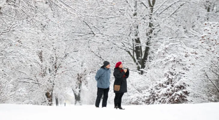
Three separate storms are affecting some Canadians this week, bringing snow, freezing rain, and near-zero visibility due to fog.
People across the country, on both coasts, woke up to weather alerts from Environment Canada warning of the upcoming chaotic weather.
Kelsey McEwen, chief meteorologist at CTV Your Morning, said the three systems are "dynamic," and will move across Canada in the coming days.
From fog to snow
Meteorologists said Thursday that the storm bringing an "atmospheric river" to the West Coast is moving over the mountains into Alberta from British Columbia.
Due to temperatures in the mountains, and parts of northern British Columbia, residents were warned they would face fog, and a morning Thursday warning was issued for an area extending to the Tibbacha region in the Northwest Territories.
The forecast said Canadians should expect "near-zero visibility" in the Cariboo area and Prince George in British Columbia, and in Fort Smith and the Salt River Reserve in the northwest of the country, and the warning said the fog is expected to clear by midday.
On the other side of the Rockies, the story is completely different.
Environment Canada issued snowfall warnings for Alberta communities near Banff National Park, including Canmore, Rocky Mountain House, and Calgary.
Meteorologists said snow began Wednesday night, and was expected to reach a thickness of between 10 to 20 cm by Thursday.
The warning said: "Higher amounts are possible in some locations, although Calgary itself is expected to receive about 10 cm," and the storm is expected to pass through the area by Thursday evening.
During the day, the blizzard is expected to extend from western Alberta to Saskatchewan communities in Manitou Lake, Marsden, and Prince Albert.
From freezing rain to snow
To the northeast in Alberta, Vermilion, Wainwright, and Bonnyville communities were warned they would face a different storm system, with "patchy" freezing rain expected in the early hours of the morning, although Environment Canada said it would end by Thursday morning.
Crossing the same system's borders into Saskatchewan Wednesday evening, McEwen said on Your Morning: "It's a real mess across Saskatchewan this morning."
A warm front spread from Alberta over the province earlier this week, and snow could mix as temperatures approach freezing, according to Environment Canada.
In central Saskatchewan, a low-pressure system is causing freezing rain in Yorkton, Pensekarth, and Kamsack.
Near the Manitoba border, total snowfall from this same weather system could reach about 10 to 15 cm, according to Environment Canada, which expects precipitation to turn to freezing rain by Thursday evening.
Environment Canada warned, extending into northern Manitoba around Lake Winnipeg, that snow accumulations "may be higher."
The "heavy" snow is expected to subside by Friday afternoon, according to Environment Canada.
A storm brewing in the Atlantic Ocean
The meteorological agency said another storm, this time coming from an area off the coast of Greenland, is expected to reach land in Newfoundland and Labrador by Thursday evening.
McEwen said: "This has resulted in some very significant warnings and alerts from Environment Canada."
Environment Canada warned of a winter storm in this area, with the need to prepare for "dangerous" conditions, and a possibility of snowfall ranging from 20 to 30 cm in higher terrain.
The website said lower amounts are forecast for the coast.
Corner Brook and Rocky Harbour communities are under warnings, and other parts of Newfoundland, including the eastern northern peninsula and Exploits Bay, were issued snowfall warnings by Environment Canada.
On the Labrador mainland, parts of Cartwright, Paradise River, and Regulet are mostly expected to remain safe, with total snowfall expected between 7 and 15 cm.
However, in Postville and Makkovik, Newfoundland, snow accumulation could reach nearly 35 cm by Friday evening.
The winter storm warning from Environment Canada said: "Snow will become heavy at times this evening. Rain may begin mixing with snow along parts of the coast Friday as temperatures approach zero."
Thursday, 03 July 2025
--°C
--°C


Comments